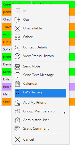
If you would like to view a user's GPS History, this can be done if the user has the Location feature enabled in their EIOBoard iPhone App. Simply right-click on the user whose GPS History you would like to view, and select GPS History.

The screen seen below will come up. It is essentially a Google Map with markers based on where the user was located by the iPhone app's GPS feature.

You can navigate around the map just as you would on Google: drag your way around the map, zoom in and out, change views on the top-right, or even change to the street view by dragging the yellow peg man on the top-left on to the map.
There are a couple of different options for showing the markers. First of all, you can change the date range of when markers are shown, allowing you to see a user's path during a specific time or date. If you check Display Path, a red line will come up that will show the exact path the user took to get from the first marker to the last marker. If you check Display All Markers, then all Intermediate markers will show up rather than just the Start and Last markers. Below is a definition for each kind of marker:
•Start: This is the first location detected in the given date range
•Intermediate: These are all the points between Start and End/Last where the user was detected. These are shown only if Display All Markers is checked, and it determines how the path (the red line) is drawn.
•End: This is the ending location in the given date range. The Last marker will show up instead if the End location is the same as the last detected location
•Last: This is the location where the user was last detected. So if it was updated recently, then this is the user's "current location".